By Students of the Fall 2023 Capstone Studio: Community Planning course, San Jose State University, December 14, 2023
San José State University’s Fall 2023 Master of Urban Planning Capstone studio students, led by Rick Kos, AICP, and Project Advisor Don Weden, took to the streets of North San José, visiting key points of interest, surveying users (resident and non-resident) to gather individual experiences, and even capturing drone footage, to answer the question, “What kind of ‘place’ is North San José?” The nearly seven-mile study area is neither uninhabited (pop. ~32,000) nor undeveloped (think of Cisco’s mega-campus or the Guadalupe River Trail), but its public realm is largely characterized by wide, car-dominant arterials and an abundance of corporate and industrial lots.
The students, in partnership with CommUniverCity and with guidance from the City of San José Department of Transportation, developed a comprehensive, forward-looking set of guiding principles and policies for North San José’s redevelopment, employing an innovative approach combining both planning and placemaking best practices.
North San Jose – Past, Present, and Future
In 1974, the City of San José began implementing the Rincon de Los Esteros Development Plan. It was around this time that North San José began to shed the last remnants of its agricultural past on its way to becoming Innovation Triangle (also known as the Golden Triangle), a hub of light industrial operations and business parks. These new land uses created a unique part of San Jose that was not predominantly zoned for the single-family residential development that characterizes much of the nation’s 12th-largest city.
Decades later, the 2005 North San José Area Development Policy sought a new trajectory for the area. This involved commercial and residential densification amidst a growing mix of land uses. Through their work, Capstone students build upon this land use planning tradition with renewed goals and techniques for placemaking.
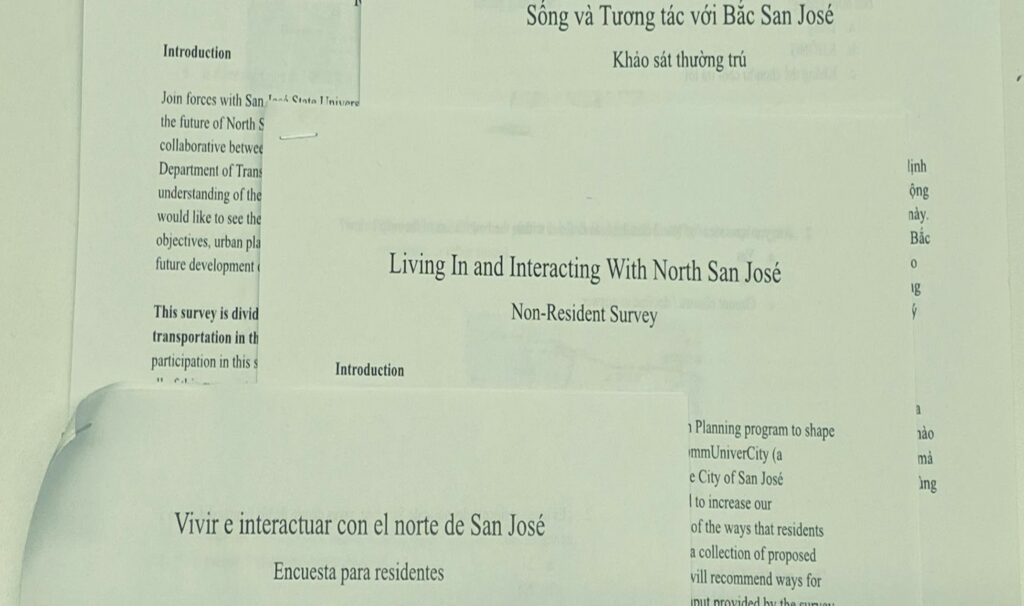
Intercept Survey – Living In and Interacting with North San José
Today, significant tension exists between North San José’s current form – characterized by wide, car-dominant arterials and an abundance of corporate and industrial lots – and an emerging vision of a more densely developed, walkable, and connected neighborhood that is, in the words of Project Advisor Don Weden, an “intelligently more urban” place.
To better understand the experiences of people living and interacting within North San José, an intercept survey was conducted at eight busy locations. Participants were asked to share their perceptions of North San José’s assets and liabilities, as well as more practical matters such as commute and non-commute transportation modes. A total of 178 surveys were collected
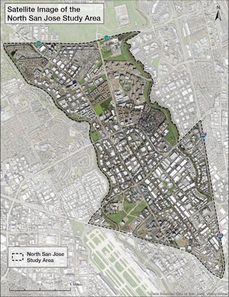
Image credit: SJSU Capstone Studio, 2023
Participants were asked to gauge whether North San José has a distinct “sense of community” on a 1-5 scale. The results averaged 3.39, which was higher than expected since the students began with a notion that North San José lacked a distinct identity. To dig deeper, respondents were asked, “What three words would you use to describe North San José to someone unfamiliar with the area?” Residents and non-residents displayed positive sentiments, including a fondness for the study area’s plentiful parks, trails, and other green spaces. On the other hand, respondents also lamented the auto-dominated landscape, few public transportation options, and long blocks that made the area difficult to navigate on foot.
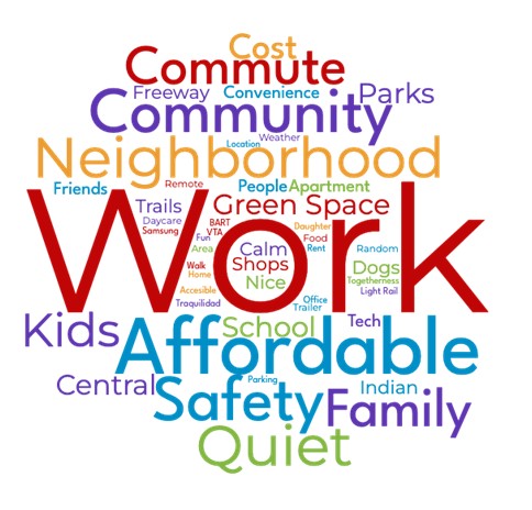
captured from the responses of over 100 study area residents. | Image credit: SJSU Capstone Studio, 2023
An interesting finding from the survey was that the rate of biking and walking as a daily commute mode was significantly higher among study area residents (20 percent) than San José’s citywide average (2.5 percent). This could be due to the close proximity of employees’ homes to major North San José workplaces such as Samsung, Cisco, and PayPal, which is an important part of the marketing strategy used by the area’s apartment complex owners.
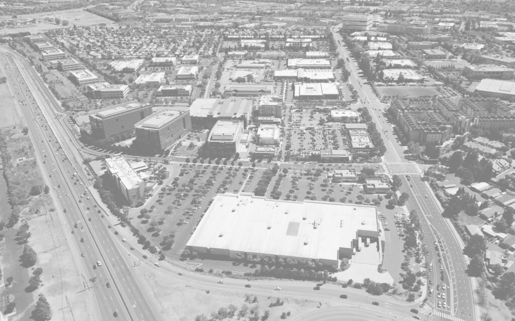
Many survey participants observed land use and zoning patterns that characterize conventional suburban sprawl without necessarily having the tools or training to call them out by name. For example, respondents remarked on how “spread out” North San José appears. Through spatial analysis in ArcGIS Pro, students confirmed that the average parcel size in North San José is six times larger than their citywide counterparts.
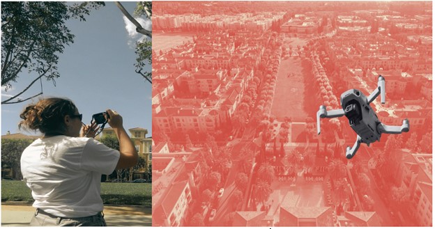
building in North San Jose. On the right side of the frame, a small drone takes an aerial photo of the same area.
Image credit: SJSU Capstone Studio, 2023
Placemaking Principles and Suburban Retrofitting Proposals
To develop actionable recommendations that draw from planning and placemaking best practices, a number of San José’s mobility and design policies were considered. Policy documents reviewed included the San José Better Bike Plan 2025, the North San José Neighborhood Plan, and the San José Citywide Design Guidelines.
From this examination of North San José’s complex regulatory landscape, five placemaking principles and strategies were developed. Students hope these principles can guide North San José’s evolution into a sustainable, attractive, suburban-urban hybrid:
- Enhance livability for residents and visitors through innovative urban design
- Ensure equitable access to housing, amenities, and services
- Celebrate the area’s culture for a strong sense of identity and community
- Promote environmental stewardship and climate resiliency
- Provide green parks and open spaces for residents and visitors
In developing these placemaking principles, a hierarchy of geographic scales was established, from neighborhood level to small streetside elements. To illustrate the principles as applied to locations of various sizes, students identified the following “opportunity sites” in the study area:
- Parking Lots (Multiple Locations) North San José
- Moitozo Orchards
- River Oaks Parkway
- Villagio Street and Zanker Road
- Zanker Road (southern terminus)
- Tasman Drive and Zanker Road
- North First Street Corridor
- Renaissance Drive
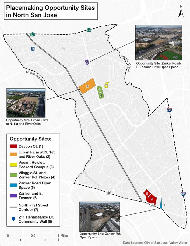
Image credit: SJSU Capstone Studio, 2023
Students offered recommendations that exemplify placemaking best practices while being consistent with the vision set forth in the City’s’ General Plan and current planning and urban design guidance.
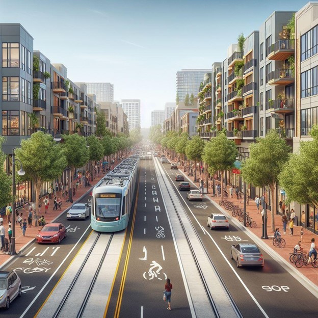
AI Image Generator, DALL E3. | Image credit: SJSU Capstone Studio, 2023
At the time of this report’s publication, the San José Department of Transportation (SJDOT) is preparing a new Multimodal Transportation Improvement Plan for North San José (NSJ MTIP). The new NSJ MTIP has the potential to be transformative for North San José’s residents, workers, and visitors.
Capstone students were inspired by North San José’s location between the Guadalupe River and Coyote Creek and titled their report “City Streams and Community Dreams: Placemaking Strategies in North San José.” They hope that their work can inform and model intelligent planning for current and future planning and policy work.
About the Authors: