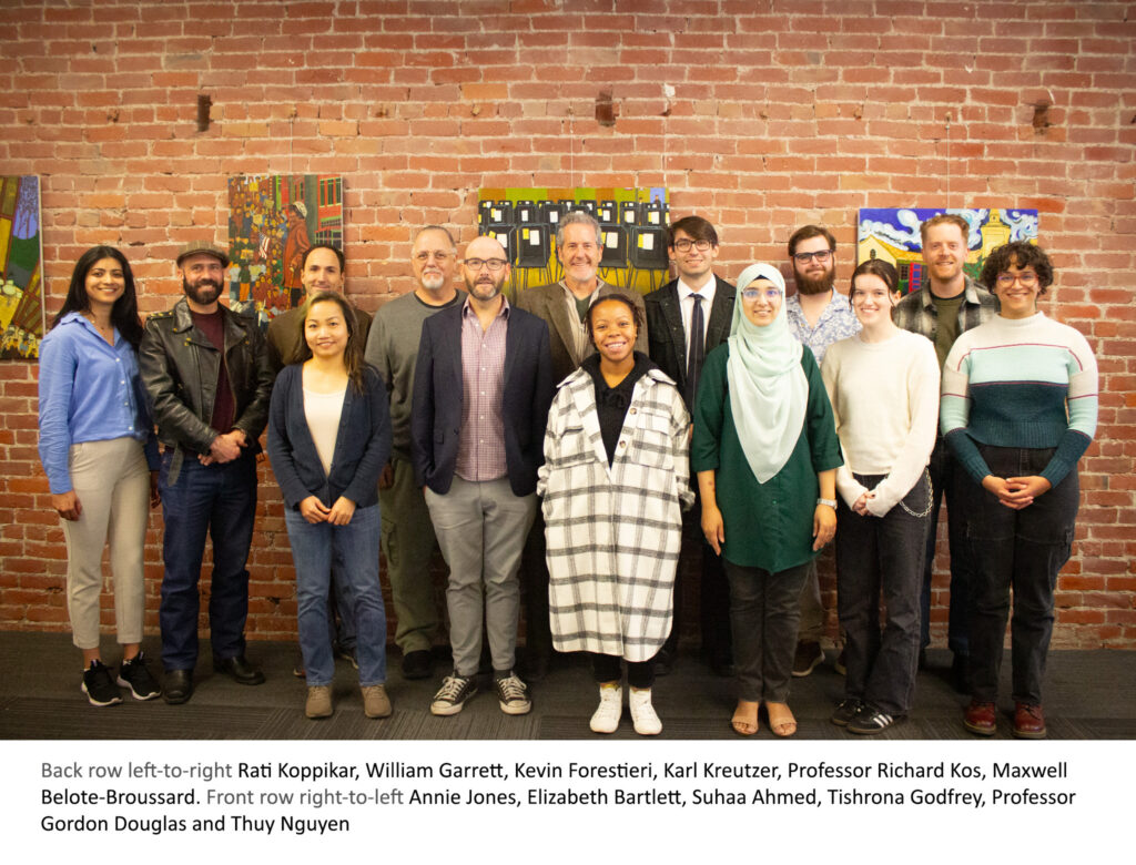
By Students of the Fall 2024 Capstone Studio: Community Planning Course, San José State University, December 10, 2024
The Fall 2024 Master of Urban Planning Capstone Studio at San José State University, led by Professors Rick Kos, AICP, and guided by Gordon Douglas, Ph.D., undertook a semester-long project to reimagine Saratoga Avenue as a vibrant, sustainable, and community-focused Urban Village. This effort followed an invitation from San José Vice Mayor Rosemary Kamei to contribute to the city’s ongoing planning process for the Saratoga Avenue Urban Village. The students’ work builds upon the foundations laid by their predecessors in the Spring 2024 class expanding the focus to encompass the entirety of the 2.5-mile stretch of Saratoga Avenue from Interstate 280 to El Paseo de Saratoga and Westgate Center shopping malls. The Reimagining Saratoga Avenue report is available online.
Urban Village Context and Vision
Saratoga Avenue has historically served as a major transportation route connecting neighborhoods to retail hubs. As a typical car-centric arterial road, it features wide travel lanes, expansive parking lots, and limited accommodations for pedestrians, cyclists, or public transit options.
Under San José’s Envision 2040 General Plan, Saratoga Avenue is part of the city’s Urban Village strategy, which seeks to reimagine suburban corridors as vibrant, mixed-use, and transit-oriented districts. This program reflects the city’s broader goals of promoting environmental sustainability, economic development, and equitable access to housing and amenities. However, the transformation of this corridor poses unique challenges due to its entrenched auto-oriented retail infrastructure and land use patterns. Challenges include limited green spaces, prioritization of vehicles over pedestrians and cyclists, and the need for inter-jurisdictional collaboration to address diverse community and transportation needs.
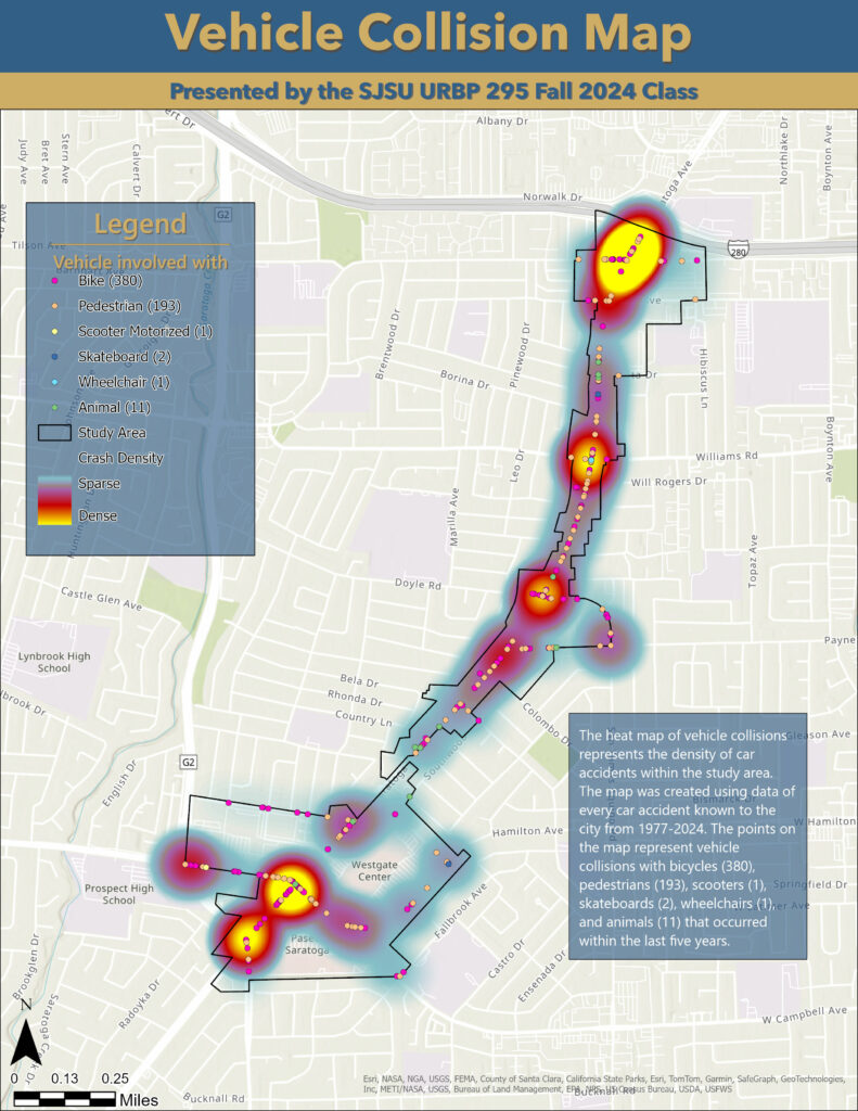
Photo credit: ESRI, State of California, and City of San José, SJSU Capstone Students, October 2024
Despite these challenges, Saratoga Avenue holds immense potential to evolve into a dynamic Urban Village. Its mix of residential neighborhoods, regional shopping centers, and civic amenities provides a strong foundation for creating a more connected and community-focused corridor.
Historical Background
Saratoga Avenue has historically been a key transportation and economic artery in West San José, connecting major routes like Interstate 280 and Lawrence Expressway while supporting suburban commerce through hubs like Mitsuwa marketplace, El Paseo and Westgate. Its role as a high-capacity, car-centric thoroughfare has defined its identity, shaped by its strategic location at the borders of San José, Saratoga, and Campbell. Today, under San José’s urban village program, the avenue is being reimagined as a community-oriented “main street” that prioritizes walkability, cycling, and vibrant public spaces. This transition reflects a broader effort to transform the corridor into a sustainable, mixed-use neighborhood that balances regional mobility with enhanced quality of life for residents and businesses through inter-jurisdictional collaboration.
Community Engagement and Insights
The graduate student team, dubbing themselves the Village Visionaries, prioritized a participatory approach, conducting extensive outreach to residents, local officials, and stakeholders. This included:
- Surveys: Distributed both online and in person, capturing feedback from residents, workers, and students about their perceptions and priorities for the area.
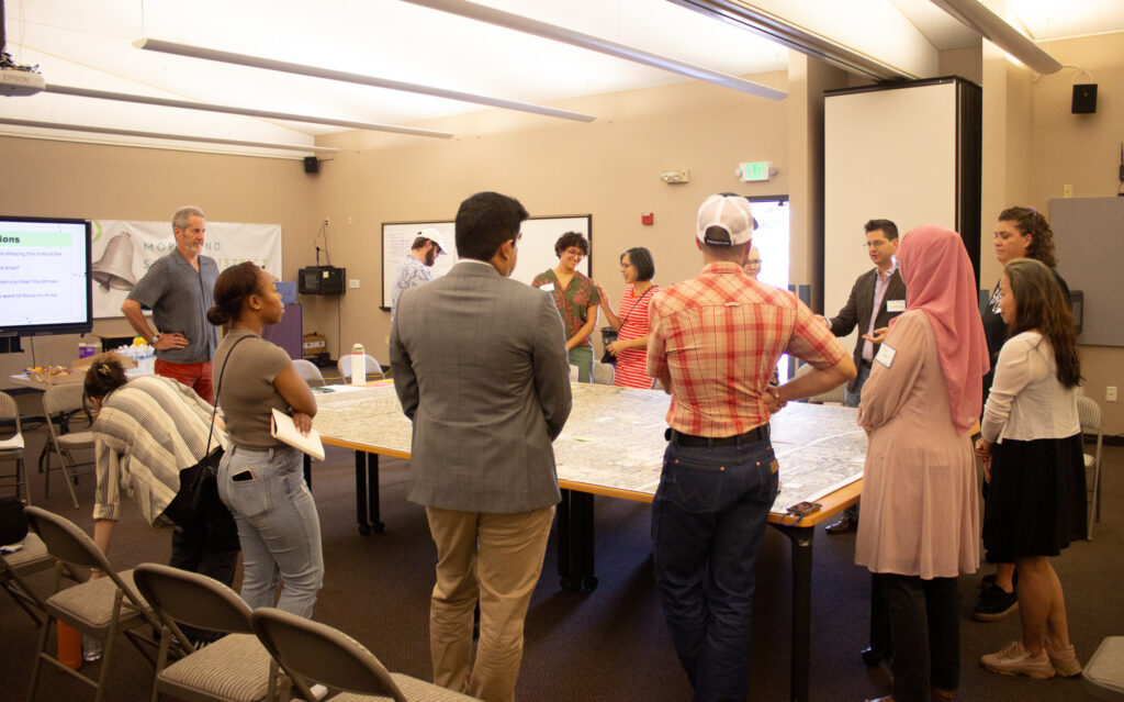
- Workshops and Public Meetings: Events were held at key community locations like Prospect High School and the West Valley Branch Library to gather input and present preliminary concepts. The team gathered community feedback by showcasing visual examples of potential street designs featuring dedicated bus lanes, protected bike lanes, and wider sidewalks. During workshops, a large aerial photo of the area was used to help participants visualize proposed changes and share input by marking their concerns and preferences directly on the map.
- Inter-Jurisdictional Discussions: Collaboration with elected officials of neighboring cities, including Saratoga and Campbell, ensured a comprehensive understanding of regional priorities. This was a specific request of Vice Mayor Kamei.
Key findings from these efforts included:
- Traffic Safety: There was a strong emphasis on improving pedestrian and cyclist safety, with community members advocating for speed regulations, traffic calming measures, the removal of slip lanes, and the creation of a continuous bike lane network.
- Demand for Green Spaces: A consistent priority across all outreach methods—including focus groups, public meetings, library events, and online surveys—was the community’s desire for more parks and green spaces, reflecting a broad consensus among stakeholders.
- Traffic, Demographics, and Economic Focus: Feedback from inter-jurisdictional meetings highlighted concerns about traffic impacts from higher-density development, the need to align housing plans with changing demographics, and leveraging Saratoga Avenue’s commercial strengths in planning efforts.
- Spatially Specific Feedback: The “Big Map” activity, where participants marked concerns and opportunities on an aerial photo, proved effective for identifying spatially relevant issues, and directly shaping policy recommendations.
- Community Identity: A recurring theme throughout the outreach was the importance of preserving and enhancing the community identity of the Saratoga Avenue area. Residents expressed a strong desire for development that reflects local character, supports small businesses, and fosters a sense of belonging, reinforcing the need for urban planning that honors both community values and future growth.
These findings informed the next steps in developing actionable planning strategies that address community concerns and recommendations. In particular, the focus was on enhancing the three activity nodes—Strawberry Park, Mid-Village Public Services, and Westgate—to create a vibrant, mixed-use urban village that reflects the needs and values of the community.
Proposed Development Nodes
The recommendations identify three distinct nodes along Saratoga Avenue that could serve as anchors for future development:
- Strawberry Park: With its Japanese-themed Mitsuwa Marketplace and cultural attractions, this northern node offers opportunities for enhancing retail and social vibrancy.
- Mid-Village Public Services: This central hub, anchored by the West Valley Branch Library, Fire Station 14, and the Payne Avenue Post Office, could evolve into a civic and recreational core with better integration of public services and open spaces.
- Westgate: The southern node, home to Westgate Center and El Paseo de Saratoga, offers significant potential for mixed-use development and pedestrian-oriented design.
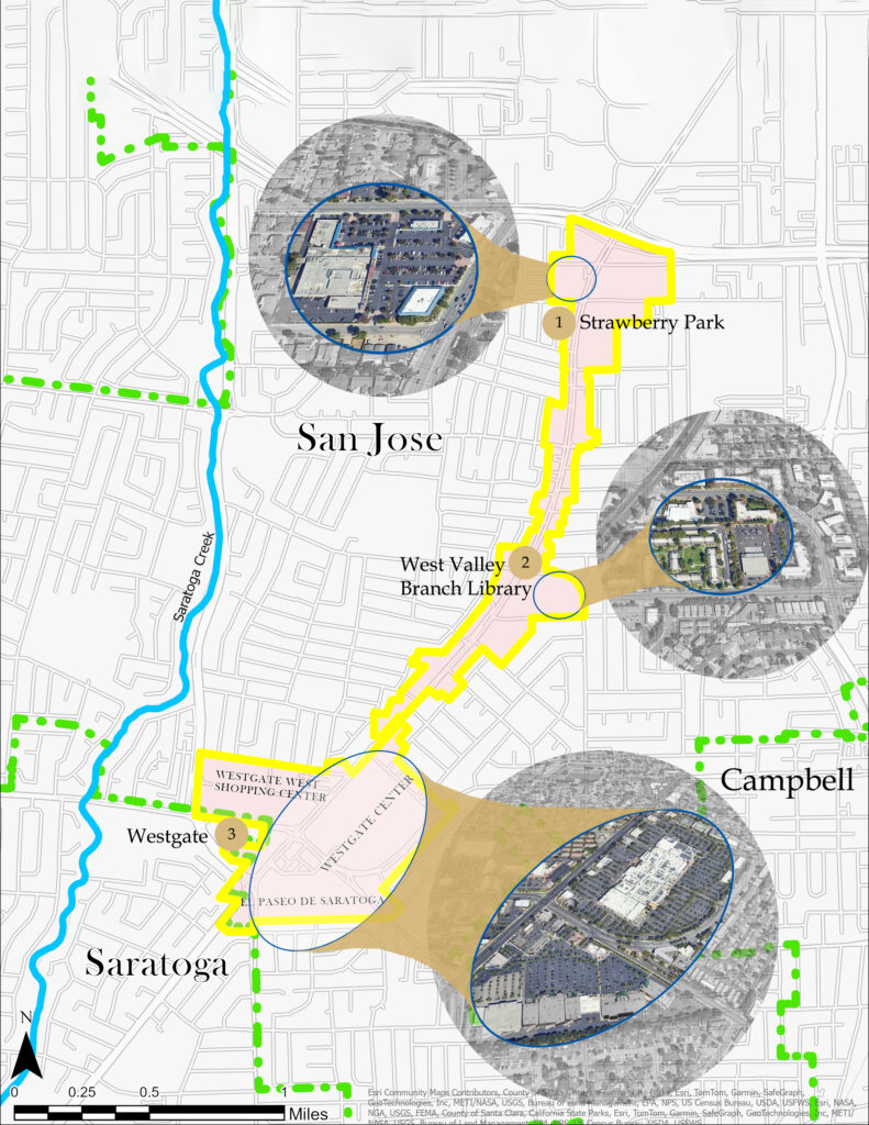
Photo credit: ESRI, State of California, and City of San José, SJSU Capstone Students, November 2024
Comprehensive Recommendations
The recommendations provided by the Village Visionaries team are directly connected to the identified activity nodes along Saratoga Avenue—Strawberry Park, Mid-Village Public Services, and Westgate—by addressing the unique needs and opportunities within each area. These recommendations are not exhaustive but represent a selection of targeted strategies focused on enhancing mobility, safety, and placemaking in these specific nodes. The four categories—Land Use, Urban Design, Multimodal Transportation & Streetscape, and Parks, Plazas, & Placemaking—are designed to guide improvements within each node while also aligning with broader community goals identified during outreach efforts, ensuring a cohesive and integrated approach to urban planning.
- Land Use and Housing
- Encourage Mixed-Use Development: Integrate residential and commercial uses to activate the corridor and reduce reliance on automobiles.
- Affordable Housing: Require that new developments include a significant percentage of affordable units to support equitable growth.
- Preserve Existing Commercial Character: Retain and modernize local businesses while encouraging ground-floor commercial activity in new developments.
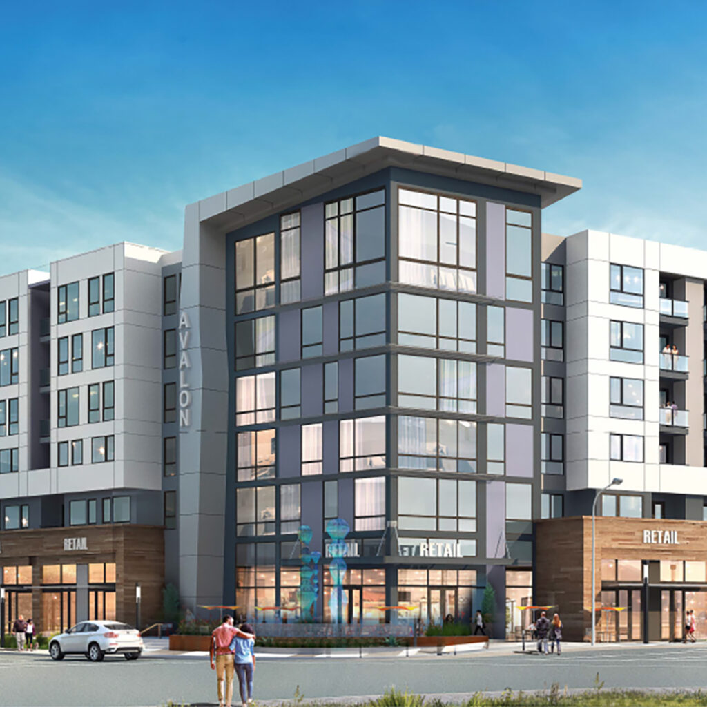
Photo credit: Studio T Square, “AvalonBay West Valley Planned Development Permit” AvalonBay Communities, Inc., October 24, 2018
- Urban Design
- Placemaking Features: Incorporate public art, pedestrian plazas, and landmark structures to foster a sense of place.
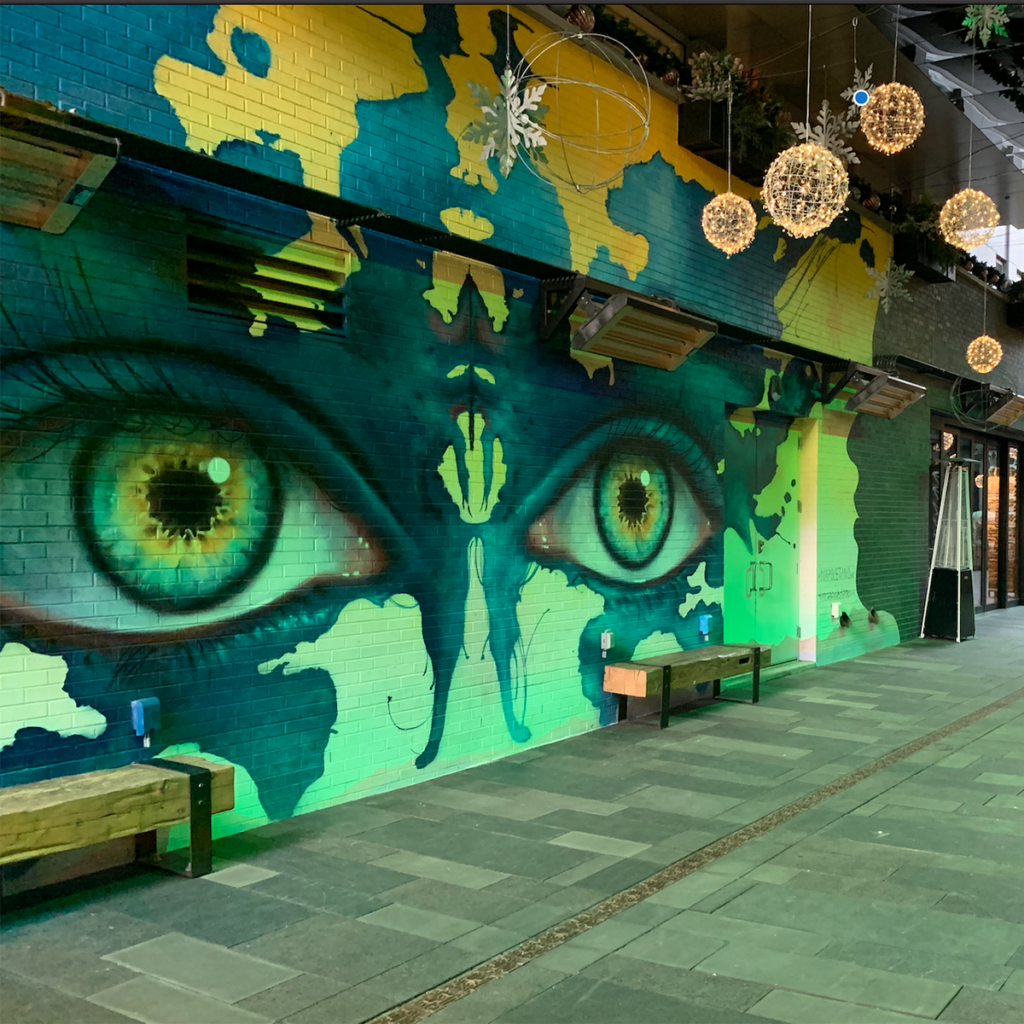
- Connectivity Enhancements: Develop mid-block crossings, wider sidewalks, and bike lanes to link neighborhoods with commercial hubs.
- Transition Zones: Use setbacks and step backs to ensure new developments blend harmoniously with existing single-family homes.
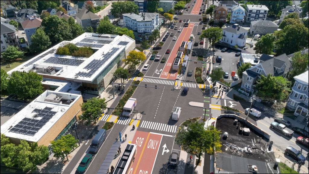
- Transportation and Streetscape
- Road Diets: Reduce travel lanes to calm traffic and create space for bike lanes, wider sidewalks, and landscaping.
- Mass Transit Improvements: Add dedicated bus lanes, enhance bus stops with shelters and seating, and consider a transit hub near Westgate.
- Pedestrian and Cyclist Safety: Install high-visibility crosswalks, pedestrian refuges, and protected bike lanes.
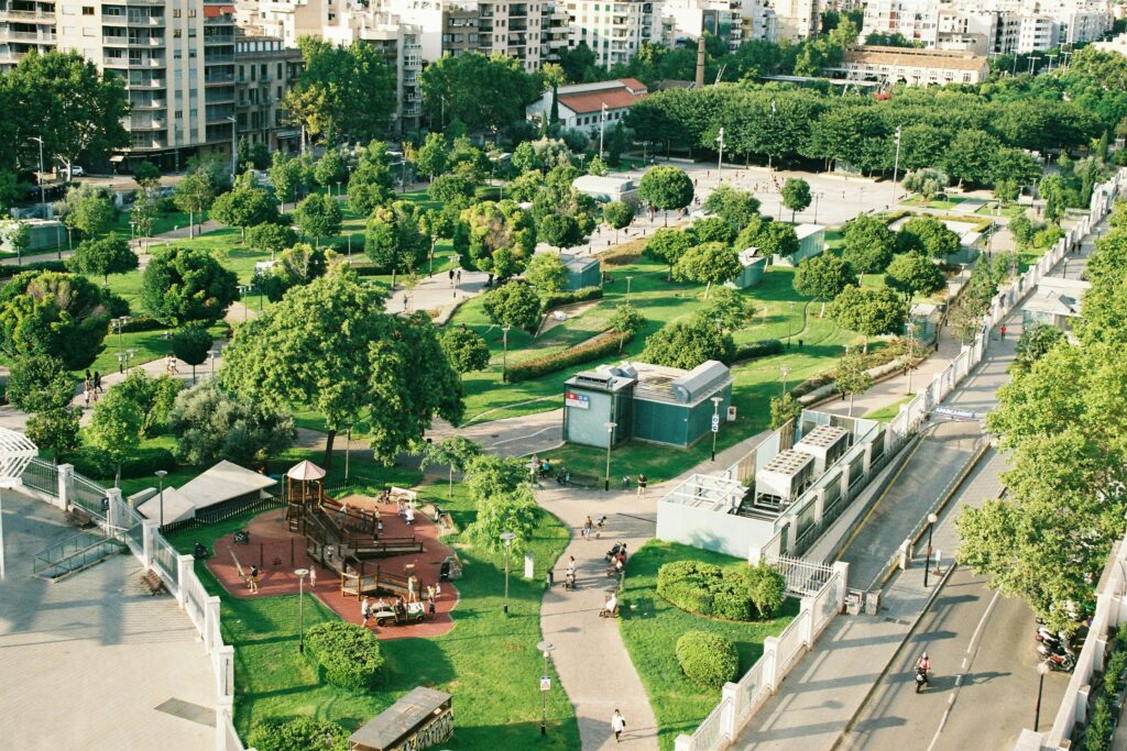
- Parks, Plazas, and Placemaking
- Expand Green Space: Transform underused parking lots into parks or plazas.
- Integrate Natural Features: Incorporate trees, water elements, and shaded seating areas to create inviting outdoor spaces.
- Foster Social Interaction: Design plazas and parks to host events, markets, and community gatherings.
Conclusion and Next Steps
The Village Visionaries’ proposals provide a roadmap for Saratoga Avenue’s evolution into a dynamic Urban Village that balances regional connectivity with local community needs. This plan emphasizes multimodal transportation, innovative placemaking, and sustainable design, seamlessly aligning with San José’s overarching vision for equity, sustainability, and an enhanced quality of life.
City officials, planners, and developers are now tasked with translating this vision into actionable policies and projects, ensuring that Saratoga Avenue becomes a model for community-centered urban revitalization in San José.
